
Trace a Warwick Street Directory
For a named road in the Town of Warwick, begin with the land rather than a supposed resident roster. Orange County identifies an address, owner name, tax-map number, or municipality as entry points to its real-property service. The result is a parcel lead. It can be checked against a dated assessment roll, a map, and a deed reference. That sequence gives a clear record trail without claiming that a current tax entry identifies everyone who lives there.
- Search the Orange County Parcel Information route by the known address, then save the tax-map parcel number and the source date.
- Open the 2026 Warwick final assessment roll for the matching parcel. Check the property location, owner-of-record, mailing line, and Deed Book/Page as separate fields.
- Use Deed Book/Page or the legal-description clues with the Orange County Clerk online-records route or the Record Room. SearchIQS requires a paid account, so the counter is the practical fallback for a known instrument or book/page.
- Check an exact mailing address with USPS ZIP Lookup. Do not use the state voter lookup as a street list: it is an individual service that requires name, date of birth, county, and ZIP information.
- For an older road or lot question, compare a dated map or local-history source before assuming the present number was used in the past. The Warwick city directories route identifies the local archival alternatives.
Each step answers a different question. The assessment roll links a property to a tax record, the deed trail records transactions, and a historic map gives period context. None alone proves present residency. Note: Preserve the record date and the custodian name whenever an address result is compared with another source.
Warwick Parcel Fields for Street Work
The county’s parcel gateway documents four basic ways into a Warwick property record. The live Beacon interface was not readable during research, so only the county-declared fields belong in an address workflow. Those fields are useful for finding the right parcel, not for building a list of people on a road.
| County search field | Entry type | Needed for a search | Verified use or limit |
|---|---|---|---|
| Owner Name | Text search | One criterion expected | County-supported mode; partial-match rules were not displayed. |
| Address | Text search | One criterion expected | County-supported mode for a known street address. |
| Tax Map number | Text search | One criterion expected | Useful after the roll or tax map identifies a parcel; format guidance was not exposed. |
| Municipality | Selection or search | One criterion expected | County-supported mode; select Warwick for the Town context. |
| Comparable analysis/report writer | Result tool | Optional after a result | County describes it, but the detailed controls were not inspected. |
The county gateway also describes property reports, assessed values, tax maps, photographs, and comparable-search functions. It does not verify auto-suggestions, street-range browsing, export, or a neighboring-parcel button. Treat those unobserved functions as unknown.
Read a Warwick Street Roll by Date
The public 2026 final assessment roll is a 4,081-page, address-sequenced fallback when a portal result is incomplete. Its stated valuation date is July 1, 2025, and its taxable-status date is March 1, 2026. It separates Village of Florida, Village of Greenwood Lake, Village of Warwick, and Town/outside-village portions. Search the PDF for a known street, parcel, or owner string, then inspect the whole columnar entry because names and fields can wrap.
The roll can show a tax-map parcel number, property location, class, owner name, owner mailing address, school district, parcel size or grid references, assessment figures, exemptions, taxable values, full market value, and Deed Book/Page. It is a dated assessment snapshot. Court-directed changes can follow publication, and a transfer can occur after the roll date. More importantly, a printed owner or mailing line is not proof that the owner lives at the property or that no other people do.
Warwick update quirk. The legacy Image Mate entry page says assessment data are updated weekly except for Town of Warwick and City of Newburgh. Compare a live result with the roll date and the Town Assessor instead of assuming a weekly Warwick refresh.
The Orange County Image Mate access screen is the county’s legacy property route. Its Warwick exception is a reason to document dates before relying on any displayed assessment detail.
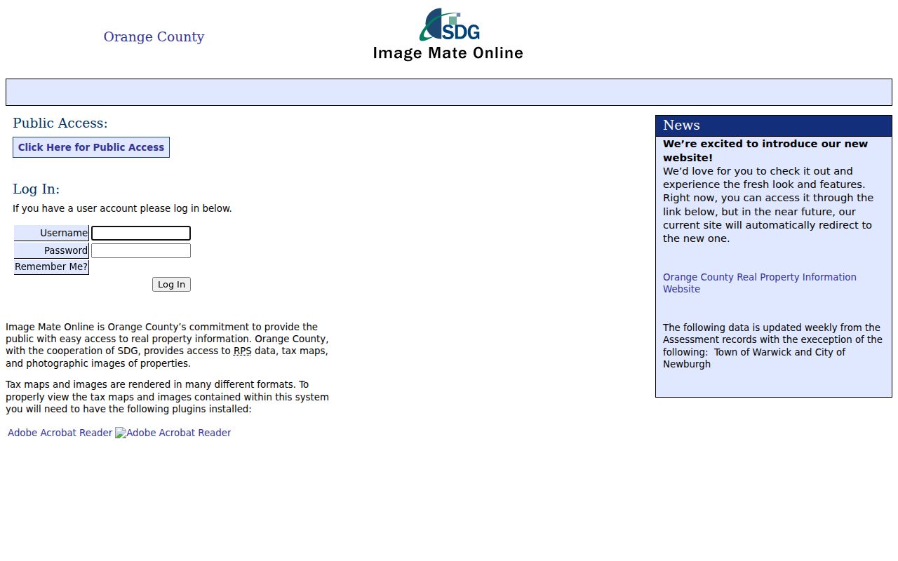
The screen supports the distinction between a property-access route and a current household directory. For a correction or an assessment question, use the local assessor rather than treating a legacy update notice as a current occupancy record.
Warwick Road Names and 911 Numbers
Warwick’s address process has a local split that matters when road records conflict. Under the Town’s published 911 procedure, proposed road names go to the Town Clerk for review against confusing existing names. Building receives a plan that shows lot lines, house locations, and driveways, then provides the address number. Planning records also require 911 addresses on plans. A road name and a building number therefore are connected, but they are not the same administrative record.
For a specific permit, certificate, notice, plan, or code file, contact the Town of Warwick Building Department. The department issues 911 addressing, permits, and certificates of occupancy, but no searchable historic permit or code-case database was verified. It says applications are not accepted by email or fax. A narrow request with an address, record type, and date range is more likely to reach the right file than a broad request for everyone on a street.
The Building Department’s address and permit information shows the Town channel for those specific records.
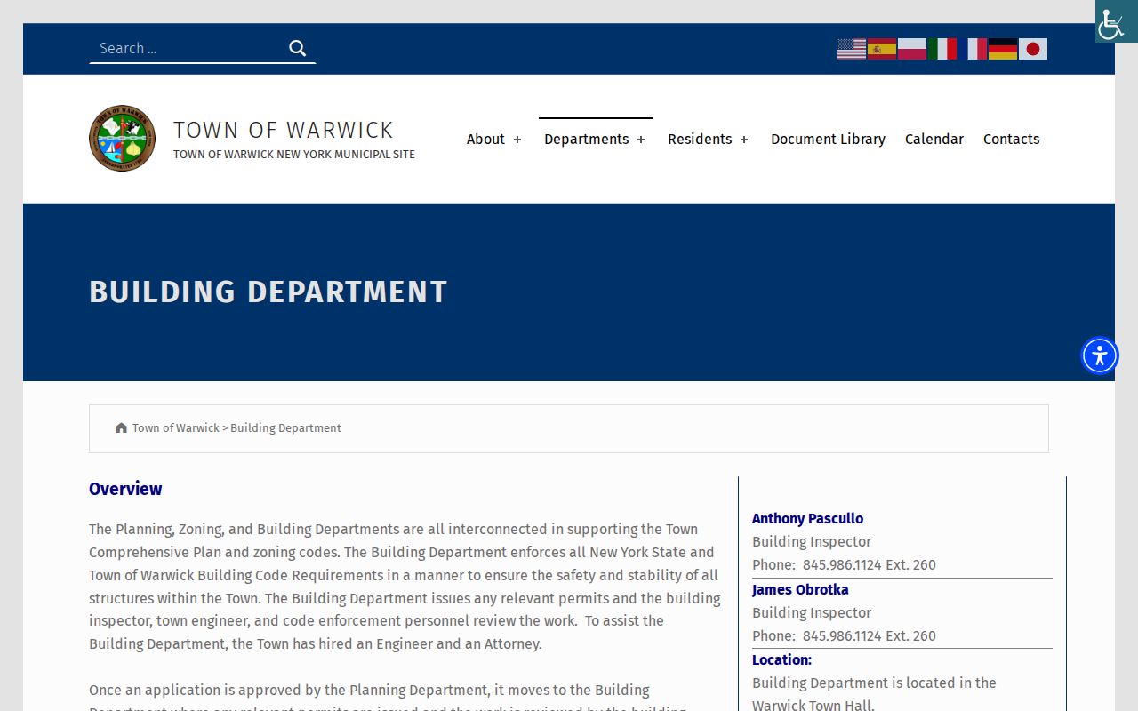
Use this Town route to ask about a defined administrative file. It does not turn a driveway plan, permit record, or certificate into evidence of current occupants.
Note: A road, parcel, delivery label, and 911 number may describe the same place differently because each office maintains a different record purpose.
Warwick Street Records by Address
Address-keyed records have different keepers and limits. The useful question is not “who is on this road,” but which public record can answer a narrow property, mapping, transfer, or address-assignment question. The table keeps owner-of-record, a postal result, and an actual resident distinct.
| Address-keyed source | Custodian and route | What it may connect | Access boundary |
|---|---|---|---|
| Property assessment | Orange County Parcel Information and 2026 final roll | Street location, tax-map parcel, owner-of-record, mailing field, values, Deed Book/Page | Address, owner, tax map, and municipality are documented modes; not an occupancy list. |
| Tax or subdivision map | County Tax Map Office, GIS link, or Clerk filed map | Parcel geometry, lot, subdivision, and district context | Use a filed or legal map for a boundary question; unverified GIS controls should not be assumed. |
| Deed or instrument | County Clerk SearchIQS or Record Room | Grantor, grantee, legal description, recording chain | Paid online account or copy route; match the legal description before linking records. |
| 911 address or road name | Town Building and Town Clerk/911 coordinator | Number-assignment plan and road-name context | No searchable historic index was verified; request a known road, plan, or date. |
| Building or code file | Town Building Department | Permit, certificate, or code-record context | No public historic lookup found; ask for a specific file or use Town FOIL. |
| Postal ZIP | USPS ZIP Lookup | Standardized ZIP or ZIP+4 for an exact address | A postal result does not establish Town jurisdiction or a person’s presence. |
| Historic map or index | NYPL 1875 atlas and AWPL 1903 map index | Dated road, lot, and place context | Not a substitute for a current address or a present-day directory. |
| Voter registration | NYS voter lookup or Board of Elections route | An individual’s own registration and polling context | No street browse; derived registration information has an elections-purpose limit. |
The table also explains why a street directory must be careful with its wording. A parcel can be physically adjacent to another parcel, a deed can name parties to a transfer, and a 911 file can explain address assignment. None of those facts identifies a complete household.
Follow a Warwick Street Deed Trail
Once the parcel and Deed Book/Page are known, the Orange County Clerk holds the land-instrument side of the research. Its Online Records route directs users to SearchIQS, which requires an account. The county lists a one-day land-index and image plan at $15, plus $5 per printed or downloaded document. Its stated 90-day plans are $150 in-state or $600 out-of-state, plus $0.50 per image page. These are access charges, not proof that every historical record is online.
The exact online beginning date and image cutoff were not available in a readable official source. For an older instrument, map, grantor, grantee, or book/page, contact the County Clerk Record Room at 845-291-3287 or visit the counter in Goshen. Ask for a particular party, instrument, legal description, or reference. The Town Clerk does not hold deeds. A deed can document a transaction and legal description, but it does not establish present occupancy.
- Parcel
- A defined unit of land in the county’s tax-map system, often identified with a tax-map number.
- Situs address
- The physical property location printed for the parcel. It can differ from an owner’s tax mailing address.
- Plat or filed map
- A recorded map that shows lots or subdivisions. It is stronger for legal context than an unverified display layer.
- Criss-cross directory
- A historical directory arranged by address rather than name. No verified Warwick run was located, so a catalog inquiry is needed before relying on one.
Note: County recording fees describe filing a new instrument, while account and copy charges govern access to existing indexed records.
Warwick Street Maps Need a Source Check
The Orange County Web Mapping Portal is the county’s named GIS route, and the county links it with its map resources. The viewer did not load reliably during research, so its current layer list, parcel-selection behavior, export controls, and nearby-property functions are not established here. The county’s mapping disclaimer also says its mapper is informational and not a substitute for field inventory or analysis.
That distinction matters along a road. A visible map edge can be separated by a road, easement, water, common area, or changed lot line. For a legal or adjoining-parcel question, compare the dated tax map, a recorded subdivision map, or a deed legal description through the appropriate county office. A map result is useful context, not a resident list and not proof that a displayed owner lives beside the property.
Warwick Street History Uses Dated Maps
Historic research can explain why an old address does not resemble a present one. The 1875 NYPL Orange County atlas sheet includes Amity, New Milford, Edenville, Pine Island, and Warwick Village. Albert Wisner Public Library also identifies a 1903 Village Map Name Index. These are period sources, not present address records.
Before connecting an atlas plate to a current parcel, check the road spelling, orientation, town or village context, legal-description clues, and the map date. An absent modern street number can reflect a rural route, a lot reference, a changed address system, or a different locality label. Historic maps add evidence only when their date remains visible.
Why Warwick Owner Records Differ
A useful Warwick street directory distinction is between property ownership and residence. The assessment roll may list a current owner, a separate mailing address, an exemption, and a Deed Book/Page. Each is tied to tax administration or a documented transaction. The fields can point to a trust, estate, entity, joint owner, bank, care-of line, or a mailing address outside the Town. They should be described as dated record fields, not as a person’s current home or contact details.
This is also a local comparison problem. The legacy Image Mate route carries a Warwick update exception, while the public final roll is explicitly dated. Neither source automatically outranks the other for every question. Compare the roll date, the local assessor’s current guidance, and a recorded deed when a difference matters. The Town Assessor handles assessment and exemption questions at 845-986-1123.
Warwick Street Directory Access Routes
Online sources are only one part of street research. Use the county parcel page, final-roll PDF, Clerk’s paid SearchIQS route, official GIS link, USPS address tool, NYPL atlas, and local library leads for their stated purposes. For material not available on the web, the Town Assessor can answer assessment questions, Building can locate a defined permit or 911-address file, and the Town Clerk can direct a road-name or municipal-record request.
At the county level, the Tax Map Office can help with parcel and subdivision context, while the County Clerk Record Room can assist with a known book/page, instrument, party, or legal description. A narrowly described municipal file may be requested through the Town’s FOIL forms route. New York Freedom of Information Law, Public Officers Law art. 6, §§84–90, does not replace normal deed, court, vital, or confidential voter procedures. For maps, photographs, and dated name-index leads, ask the local library or historical archive about a specific road, map year, or collection.
Limits of the Warwick Street Directory
Public property and map records do not reveal a full street household. Occupants who are not shown as owners, additional household members, utility customers, driver data, protected people, and sealed or restricted records are not a lawful substitute layer. New York’s Address Confidentiality Program can provide a substitute address under Executive Law §108, and confidential voter registration is separately protected under Election Law §5-508. An absent result may reflect a lawful protection, not an error or a conclusion about where someone lives.
Motor-vehicle records are not an address workaround under the Drivers Privacy Protection Act. The Town’s no-public-permit-database limit is also meaningful: a missing web result does not prove that a permit never existed. Ask the custodian for a particular record and record date, then leave a conflict unresolved until an official source answers it.
Lawful use. Warwick address records are for narrow, personal, lawful research. Do not use parcel, map, court, voter, or vehicle information to stalk, harass, threaten, or intimidate anyone; New York Penal Law §120.45 addresses stalking.